 Castle Surveys Limited are one of the fastest growing multi-disciplinary surveying practices in the UK. We provide specialist surveying services to architects, planning consultants, utility companies, government agencies, engineers, ecologists and various other construction related professionals.
Strategically located in the market town of Ashby-de-la-Zouch in the East Midlands this enables us to provide nationwide coverage.
We pride ourselves on delivering high quality, detailed and accurate Topographic & Measured building surveys for our valued clients.
Business details
- Licensed
- Insured
Associations and certifications
- SMAS Health & Safety
- Construction Line
Payment methods
- Cash
- Debit cards
- Credit cards
Services
Topographical Land Surveys
Report
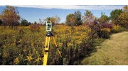
 As one of the country’s leading surveying companies in the UK, Castle Surveys Ltd provide an all in one surveying solution tailored to our client’s specifications. Based in Ashby de la Zouch, we have easy access to provide topographic land surveys in Leicester, the Midlands and the rest of the UK.
 Utilising Leica robotic total stations (also known as theodolites) , Leica GNNS/GPS systems in conjunction with LSS digital terrain modelling (DTM) & computer aided design (CAD) post-processing software, ensures that we deliver the highest quality and accurate products at competitive rates. All of our surveys are measured in 3D and are supplied in various 2D or 3D formats. Paper copies can be provided on request. Our aim is to provide you with exactly what you need, on time and within budget.
Measured Building Surveys
Report
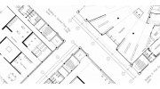
 Castle Surveys carry out all of our measured building surveys using Leica disto laser measurers coupled with site laptops running MBS Floor Plan software. The software shows the misclosure on site, in real-time, enabling our surveyors to immediately see where control measurements are needed to meet the accuracy requirements of the project. A wide variety of measurement methods can be chosen, depending on the particular building being surveyed. Intelligent data is collected at the same time as the measurements and attached in the form of attributes to allow for detailed analysis back in the office. In addition, we utilise our Leica total stations internally to traverse through the building, ensuring our surveys are measured to the highest level of accuracy.
 Laser Scanning Surveys
Report
Highway Surveys
Report
Highway surveys are used to provide highly accurate and detailed plans of the existing road network. Features such as the location of kerbs, utilities, drainage, neighbouring buildings, overhead cables, camber of the road, street furniture and many more. Utilising the latest survey equipment, Leica reflectorless robotic total stations, GNSS GPS systems and LSS survey software, we are able to carry out the survey of the highway with minimal disruption to the flow of traffic which can easily be imported into most design software.
Setting Out Services
Report
Castle Surveys offer setting out services for a variety of projects including, roads, sewers, housing foundations, pilling projects, steel frames, pipelines, wind turbines, solar panels and many more. Utilising the data provided we can determine the co-ordinates and input these into the total station to accurately position pegs or pins to located the specific points.
Land Registry Title & Boundary Plans
Report
Here at Castle Surveys we undertake boundary surveys to determine the position of boundaries to prove whether encroachment has taken place. We accurately survey the boundaries or area in question using out state of the art survey equipment to determine the position of boundaries in the real world to assist your solicitors in resolving the claim.
Green Field Site Surveys
Report
Greenfield sites are undeveloped pastures of land in a city or rural area either used for agriculture, landscape design, or left to evolve naturally and potentially being considered for urban development. This is a highly contentious issue, particularly in the UK, where the development of land is split between Greenfield and brownfield sites. It becomes contentious, and political, due to a limited amount of physical space available, competing with an expanding population that needs housing.
Brown Field Site Surveys
Report
In the UK a brownfield site is defined as “previously developed land” that has the potential for being redeveloped. It is often (but not always) land that has been used for industrial and commercial purposes and is now derelict and possibly contaminated. The lack of available green spaces for development purposes has meant that brownfield sites have become increasingly popular in recent years, especially in places where demand for residential and commercial property is high.
Desktop Based Assessment
Report
Prior to the commencement of an Underground Utility Survey, we offer the option to undertake a desktop-based assessment of the site. We acquire plans from all the statutory bodies relating to your site which aids in the quality of the survey. It may also flag up services that cannot be located (for whatever reason.)
Some clients may not require a full underground utility survey, but need to know what might be underground. Here at Castle Surveys we can source recorded information relating to the presence of existing underground pipes, cables and services, which can then be overlaid onto a topographical land survey, or simply made into one single document.
Some clients may not require a full underground utility survey, but need to know what might be underground. Here at Castle Surveys we can source recorded information relating to the presence of existing underground pipes, cables and services, which can then be overlaid onto a topographical land survey, or simply made into one single document.
Utility Mapping
Report
The next stage of the process is for us to undertake a full underground utility survey. This will map out the locations, depths & identify the type of services on site. All surveys are surveyed utilising Electromagnetic Detection Methods (EDM) & Ground Penetrating Radar (GPR) equipment and post-processed in CAD. The final drawings are sent in PDF & DWG format.
Ground Penetrating Radar (gpr)
Report
Manhole Assessment Surveys
Report
Castle Surveys can undertake a range of manhole & inspection chamber assessments. This information includes the inspection chamber cover levels, chamber size and pipe details including the invert levels, material and pipe diameter. This can be added onto our topographical land surveys as an additional service if required.
Cctv Surveys
Report
Drain CCTV surveys and inspections can now be implemented to determine the pipe condition and any defects or faults you may have. This type of drain survey can provide a fast and cost-effective way to diagnose any drainage problems. We can then record the findings and produce a detailed report, plan and DVD.
Pas 128
Report
With a range of different survey types, detection methods, quality levels and geospatial locations, the PAS 128 utility survey provides a more detailed selection criteria to facilitate the confidence in the data provided. It covers the project planning and scoping process, classification system for quality levels, desktop utility records search and detection, verification and location.
Reviews (15)
Rebecca Mushambi
Jun 24, 2022
We had a measured survey done by Castle Surveys and we were very pleased by their excellent service. Good communication throughout. The lads were a pleasure to have around, lovely and polite. The price for the survey was very good value, more than 1K lower than another quote I had! Would highly recommend their services :
Jc C.
Apr 20, 2022
Really professional team at Castle Surveys. Spent time to understand the requirements of client - full internal and external survey of residential property outbuilding and garden for a remodel. Site crew was prompt tidy and courteous. Best I can say is that the process was painless. Very happy to recommend Castle Surveys.
Gregg Garner
Jan 19, 2022
We used Castle Surveys when we needed a large measured building survey of our house fo a renovation project. The service was excellent. We had great communication from beginning to end, they were professional and thorough. It was good value, I would use them again if we ever have a need for another survey.
Michael Hames
Sep 19, 2021
Caroline Smith
Aug 27, 2021
Matt Fry
Jun 14, 2021
Castle Surveys were recommended to us via our architect. They were very responsive and carried out the survey promptly as we were under pressure to get the proposals into planning. Paul and the team that carried out the survey were polite and on time. From the survey to the completed plans was only 5days. Would recommend to anyone needing these types of services.
Base Architecture
Jun 14, 2021
Castle Surveys are a professional and reliable firm we have been working with since they established. They have undertaken numerous measured building and topographical surveys for us throughout the country. Their team are extremely professional and prompt and always courteous to homeowners. The work is to a high standard and promptly turned around. We look forward to working with them for many years to come.
Aaron Sherwin
Apr 21, 2021
We commissioned Castle Surveys on recommendation from our architect. They were very prompt, polite and even surveyed the outbuilding which they did'nt price for but were happy to do. The completed survey was turned around in a few days and our architect was very happy with the level of information and detail produced. I would highly recommend to anyone needing a survey.
Tyrone Birch
Oct 24, 2020
I recently commissioned Castle Surveys on recommendation of my architect. Castle Surveys provided a great service at a very competitive price. As a client I was very happy with the quality of work and how detailed the plans were. We also asked for the 3D BIM model providing fantastic visual representation of our house. Thank you Paul for an excellent service.
Stuart Yb
Oct 21, 2020
Castle Surveys were recommended by a former colleague and their work and professionalism were excellent. Their quote was competitive and their timescale for undertaking the work was compact. Most importantly however it was the fact that they arrived and undertook the work at the agreed time and produced the survey data within the required timeframe. Their customer communication and service were excellent. We will use them again. Syb
Simon
Sep 15, 2020
As a company we have used Castle Surveys on numerous and a variate of projects throughout the UK. We have always been very pleased with the service they provide and the information is returned promptly, timescales are adhered to and its always been high quality compared to other comapnies we have used in the past. I would highly recommend this company.
Anna Ward
Jul 23, 2020
We recently used Castle Surveys to carry out a Measured Survey on a property we are looking to purchase and renovate. The surveyors on the day were very professional and got on with their work quietly and efficiently with minimum disruption to the vendors. The final report was produced in the timescale agreed and we would definitely use them again in the future.
Gina O'Sullivan
Jul 16, 2020
Ali McKendrick
Mar 06, 2019
Kirsti Williams
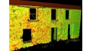
 Surveys utilising laser scanners can capture environments by collecting millions of precise measurements in a matter of minutes. These measurements or vectors coordinates are then pieced together to form what is known as a "point cloud".